I had brought a book called "Aviemore and
the Cairngorms: 40 Shorter Walks by Paul & Helen Webster", this little
pocket book is a good source if you are looking for either ideas for walks or
just wanting short a walk. When my Grandmother came to visit and had expressed
an interest in going walking in Aviemore, I gave her the book to look at. From
this she picked two walks; Pattack Falls and a walk in the Craigellachie Nature Reserve. Even though
both walks are very short, they allow you to view a lot of beautiful scenery
within the Cairn Gorm National Park.
It was decided to go to Pattack Falls
first, as it was furthest point.
Pattack Falls was
the shortest and easiest walk that I have done, a mere 500m on flat
ground, taking under 20 minutes to complete (yellow path). The path passes the
falls, then after a short walk in the woods, you come to an
open heather-ed area with views of the mountains in the surrounding
area. The path then slits in two, one route goes further into the woods and to the ruins of the
deserted village of Druim an Aird, the other goes back to the car park. (We
chose this one). This path went back into the forest and then to the car park.
Even thought this was a very short walk, I did enjoy it, the falls where very pretty and this is a worthwhile spot
to stop if passing through.
After some lunch in the Happy Haggis (I love the
name!!!) It was time to move onto our main walk in the Craigellachie
Nature Reserve.
The Craigellachie
Nature Reserve is located behind St Aidan's Catholic Church and Aviemore
Youth Hostel. There are a view routes within the nature reserve, simple
all ability paths around a pond (the pond seemed to be missing the water), a
longer route along the base of the hill and then the longest walk up to a
viewpoint on a hill that seems to have no name. We chose to do the viewpoint
trail.
A - Aviemore, B - Start/Finish, C - Summit of No-Name Hill
This path is well signposted and is a single track that is mainly gravelled
however parts are quite rocky. To begin the walk you have to walk
under the noisy A9 via a bridge that goes under the road. The
first segment of route is quite unimpressive, mainly due to the "missing" pond; however after
this you enter a sliver birch forest. The path runs around the base of the hill
and at this point rises VERY slowly. The path seems to stay like this until you
come to a water reservoir, then the elevation becomes much steeper
in comparison. This part of the route more or less goes straight up the
hill. Towards the top of the first hill, you come across some stone stairs. My
Grandmother referred to them as "The Stairway to
Heaven" luckily she was wrong!!! After climbing these you reach
the top of the first hill (about 477m). From here you can see the ski lifts on
the Cairn Gorm as well as Aviemore and also surrounding hills/mountains. My
Grandmother stopped here but I continued on until I reached the top of the next
hill. From the top of this hill (about 542m), you get a better view of the
Cairn Gorm. The decent from the hills were surprisingly simple, just
straight down. We decided to go back the way we came but you could have
followed a few alternative paths to the bottom.
The
completed walk took under an hour and a half to walk and was 3 miles
in length.
I enjoyed both walks, even if they were shorter than what I would normally walk. I would like to revisit Pattack Falls to explore more of the forest and hopefully I will.....
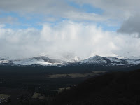
Here are some pictures from the walks:


All Comments are Welcome!!!


thoroughly enjoyed both walks, the area around Pattack Falls I found very pretty and peaceful, would like to return there one day
ReplyDelete